Total Page Views for HatBangBird: 100,737 - Views this week: 100,737
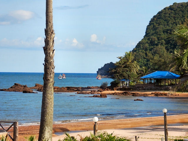
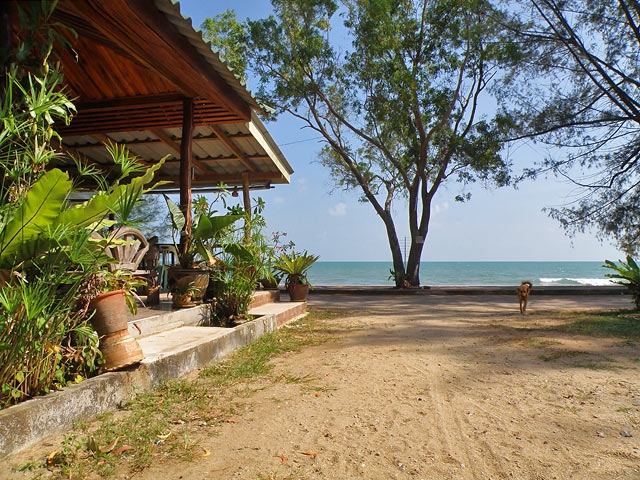
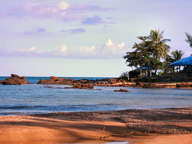
The 10 km-long sandy beach is fringed by pine trees, bordered by tall dunes in the south and framed by steep mountains. Unfortunately, the people living in the small village of Ban Bang Bird as well as the visitors coming to this beach did not learn yet, how to dispose of the rubbish environmentally friendly. The resorts try hard to keep the beach clean. Large parts of beach properties belong to the royal family and building on these premises is not permitted.
Alternative route on side roads It is quite an adventure to drive south from Bang Saphan (Yai) to the beach of Pathio (86 km), because there are rarely any signboards indicating the direction to the south. On lightly trafficked road H3374 you drive first in close vicinity to the beach for 27 km south. At the road junction at KM 27,1 do not continue straight on the rather boring H3411 via Map Amarit (25 km), but turn left in order to enjoy the beautiful landscape near the sea. After 4,1 km take a sharp turn right on crossroad H1015.
Then continue for 4 km and turn left into a track (800 m) to Ban Sai Thong Beach where a Thai resort is located. Another lane leads 100 m behind to the black volcanic rock at the sea where you find another beach resort with blue roofs. If you go straight on, you reach a crossroad after 2,4 km that leads east to the fishing village of Ban Bang Bird (500 m) and to the west after 16,5 km to H4 at KM 425,8. You can make a short detour to the beach, after that you continue 700 m to the west and then you turn left in the direction of Pathio. The 9 km-long road H4015 crosses Nirvana Sand Dune.
Passing a pier for fishing boats you drive through agricultural land. After 1 km, a signboard indicates to turn left to Koh Teap Beach (5 km). Beautiful views are offered from the road to steep rocks and magnificent bays. After 4 km, a viewpoint at a Chinese temple with a statue of the Goddess of Mercy offers a beautiful view to an elongated peninsula formed of sand deposited by the sea, covered with casuarina trees. Another 9 km further you turn left into H4015 in the direction to the fishing harbor of Thung Maha. The road bends right into H3253 (signboard: "Pathio 25 km"), just before there is a small hotel. You continue on this road, passing along palm oil and rubber plantations. After 11 km, do not turn on H3253 to Pathio, but go straight on H4004 in the direction of the airport and Chumphon, until you see the beach of Pathio after about 10 km. Here you can find accommodation in small bungalow resorts (86 km from Bang Saphan).
The remaining 33 km to Chumphon you mainly drive straight on (except after 7 km you have to turn left, but it is signposted) the good roads H3201 and H3180, if you do not plan to make a detour to Thung Wua Laen Beach.
New to t-Globe?
Register for free to get the full power of this web site!
Name
Email
Password
Confirm Password
Registered members will be able to:
use our Interactive t-Maps
see Business Neighborhoods
print a customized PDF Guidebook
get discount coupons for hotels, restaurants and other services